Topographical Survey
Enquire Today For A Free No Obligation Quote
At Topographical Survey, we provide detailed mapping of physical features and ground levels on a site, using precision instruments to record horizontal and vertical positions of natural and built elements.
As accurate site data is critical for design, planning, and engineering, topographical surveys are used to create reliable base plans that guide every phase of development, from concept to construction.
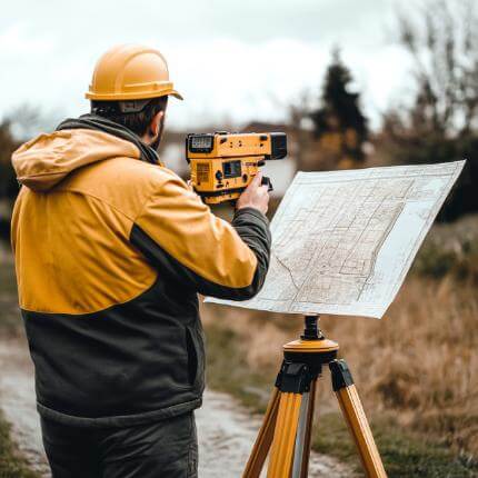
Professional surveyors carry out topographical surveys using total stations, GNSS receivers, and 3D laser scanners to capture buildings, boundaries, kerbs, trees, utility covers, levels, and terrain changes.
Whether the project involves a private residential plot, commercial development, public infrastructure, or landscape design, a topographical survey provides the essential data needed to make informed decisions from day one.
Request a free quote to get expert services from our topographical survey company today.
What is a Topographical Survey?
A topographical survey is a measured site survey that records visible surface features and elevation data within a defined area.
The survey data is captured using geospatial equipment and is processed into digital drawings that represent ground levels, gradients, and the position of features such as roads, walls, paths, fences, drainage covers, vegetation, and buildings.
Since every site has unique contours and constraints, a topographical survey ensures that planners, architects, and engineers are working from accurate, real-world conditions.
Why Are Topographical Surveys Important?
Topographical surveys are important because they reduce design errors, avoid unexpected site conditions, and improve coordination between disciplines.
Because many construction problems arise from poor or outdated site data, having a recent, accurate topographic base allows all stakeholders to work from the same set of facts.
This contributes to better risk management, smoother planning approvals, and reduced project delays due to unforeseen ground-level issues or incorrect assumptions.
What Is Included in a Topographical Survey?
A typical topographical survey includes features such as boundary lines, access roads, footpaths, kerbs, fences, retaining walls, manholes, street furniture, trees, and vegetation.
Ground levels are recorded across the entire site using spot heights and contours to show slope, gradient, and surface undulation.
Surveyors also record critical infrastructure such as utility covers and drainage features if visible on the surface.
All data is tied to national grid coordinates or a site-specific reference and is delivered in CAD formats such as DWG, along with supporting PDFs or CSV files as required.
How Accurate Is a Topographical Survey?
The accuracy of a topographical survey depends on the equipment used, site conditions, and required level of detail.
Under standard conditions, modern surveys achieve horizontal and vertical accuracy of ±10 to ±25 mm, which is suitable for most design and construction tasks.
Where required, tighter tolerances can be achieved using fixed survey control, dense spot grids, and laser scanning techniques.
How Much Does a Topographical Survey Cost?
The cost of a topographical survey ranges from £500 to £2,500 or more.
The cost depends on the size of the site, the complexity of features, and the level of detail requested.
Small residential sites or driveways may fall within the £500 to £850 range, while commercial, multi-acre, or infrastructure sites may range between £1,200 and £2,500+.
As every site presents unique challenges, such as vegetation, access constraints, or integration with utility data—a tailored quote is always provided following a review of site plans or client requirements.
Where Are Topographical Surveys Used?
Topographical surveys are used in a wide range of sectors including construction, civil engineering, transport infrastructure, utilities, environmental planning, and urban design.
They are commonly required during pre-planning, feasibility studies, detailed design, drainage strategy preparation, and site layout development.
Whether the site is rural, suburban, or urban, a topographical survey supports accurate and risk-aware project decisions.
What Are the Benefits of a Topographical Survey?
A topographical survey provides the foundation for design accuracy, project efficiency, and long-term planning success.
The key benefits include:
- Accurate baseline data – Reduces the risk of incorrect assumptions in design or planning
- Better project coordination – Enables architects, engineers, and contractors to work from the same verified plan
- Smoother planning approvals – Helps demonstrate site constraints and opportunities to local authorities
- Supports drainage and level design – Provides elevation data critical for SuDS and infrastructure planning
- Reduces rework and cost overruns – Identifies risks and limitations before construction begins
- Integrates with digital workflows – Compatible with CAD, GIS, and BIM platforms
- Adaptable for any site – Can be customised for residential, commercial, industrial, or public sector projects
As reliable site data underpins the success of any built project, a professionally delivered topographical survey is one of the most valuable early investments you can make.
How Is a Topographical Survey Delivered?
The results of a topographical utility line survey are delivered as digital CAD drawings, supported by contour plots, spot levels, and feature annotations.
Plans are provided in DWG, PDF, and CSV formats, and can be geo-referenced to Ordnance Survey National Grid or to a client’s local coordinate system.
Upon request, surveys can also be delivered as 3D models, GIS shapefiles, or Revit-compatible outputs for integration into BIM environments.
Can Topographical Surveys Be Combined With Other Surveys?
Topographical surveys are often combined with related services such as utility mapping, measured building surveys, CCTV drainage surveys, and land registry boundary plans.
As combining these services creates a complete picture of the site above and below ground, many clients prefer a coordinated package from a single survey provider.
This reduces duplication, saves time, and ensures all spatial data aligns correctly for design and construction phases.
How Quickly Can a Topographical Survey Be Completed?
Most topographical surveys are completed within 1 to 5 working days depending on the size and complexity of the site.
Following the field survey, CAD processing and quality assurance usually take an additional 3 to 7 working days, though fast-track options are available on request.
Timelines depend on access, weather, and site constraints, so early engagement helps ensure prompt delivery.
Can a Topographical Survey Be Used for Land Registry Plans?
A topographical survey can be used to support Land Registry-compliant plans, especially when accurate boundary positions or lease plans are required.
Because the survey captures precise measurements of boundaries, walls, fences, and permanent features, it provides a reliable base for producing title plans, leasehold drawings, or first registration documents.
Surveyors can tailor outputs to meet HM Land Registry scale and layout requirements, including redline boundaries and OS referencing.
Are Drone Surveys a Substitute for Ground-Based Topographical Surveys?
Drone (UAV) surveys can complement ground-based topographical surveys but are not a full substitute when high-precision data is required.
As aerial photogrammetry is ideal for covering large or inaccessible areas quickly, it is often used for rural land, stockpile volumes, or environmental studies.
However, for sites requiring tight vertical accuracy, detailed ground features, or legal boundary confirmation, total stations and GNSS equipment still provide superior control and resolution.
Can You Show Proposed Features on the Topographical Survey?
A topographical survey is a record of existing conditions, but we can overlay proposed features such as building footprints, access roads, or drainage alignments if design data is provided.
Since overlaying design elements on accurate survey data helps visualise impact and feasibility, this service is frequently used during planning and early-stage design.
We coordinate with design teams to ensure all elements are correctly positioned and aligned to site coordinates or grid references.
How Do You Survey Steep or Irregular Terrain?
Steep, uneven, or irregular terrain is surveyed using a combination of GNSS, total stations, and laser scanning equipment to capture levels accurately across all slopes and elevations.
As elevation changes can affect drainage, access, and buildability, extra care is taken to ensure adequate spot height density and contour detail.
We may also use long-range scanning or drone imagery in areas where the ground is unsafe to access directly.
Can Topographical Surveys Be Used for Cut and Fill Calculations?
Topographical surveys provide the elevation data required for accurate cut and fill analysis during earthworks design.
Since spot levels and contour data allow engineers to compare existing and proposed ground levels, they can calculate the volumes of material that need to be excavated or imported.
This supports cost estimation, material management, and environmental control during site preparation.
What Level of Detail Can Be Included in a Topographical Survey?
The level of detail in a topographical survey is entirely flexible and depends on the client’s specification.
We can provide basic feature location and levels for outline design or include full detailing of elements such as kerb lines, street furniture, tree canopies, manholes, and surface materials.
If required, additional features such as visible utilities, signage, lighting columns, and ground textures can also be recorded.
Do Topographical Surveys Cover Trees and Vegetation?
Trees and vegetation can be included in a topographical survey, including the position, trunk diameter, canopy spread, and height if required.
Since tree data is often needed for arboricultural assessments and planning applications, we can tag trees with unique identifiers and plot them on the CAD drawings.
More advanced tree surveys (BS5837 compliant) can also be commissioned alongside the topographical survey.
Can You Survey for Utilities Whilst Inside Site Boundaries Only?
A topographical survey can be restricted to within site boundaries if adjacent land access is not available.
Where possible, surveying a buffer area beyond the boundary, such as pavements, neighbouring walls, or access roads, adds value to the final drawing and helps inform drainage, access, and design considerations.
If access is restricted, we can still include contextual features using long-range measurement or visible estimation with appropriate disclaimers.
Can Topographical Utility Inspections Be Carried Out in Poor Weather?
Topographical assessments can be conducted year-round, including during winter months, although heavy rain, snow, or high winds may limit the visibility of features or affect equipment accuracy.
As consistent weather conditions produce more reliable results, we advise rescheduling in the event of extreme conditions, particularly for UAV or laser scanning work.
Safety assessments are also conducted on-site before work begins, especially during adverse weather.
How Do You Ensure Compatibility with BIM and GIS Platforms?
Topographical surveys are processed with digital integration in mind and can be supplied in file formats compatible with BIM (Revit, IFC) and GIS (SHP, GeoJSON, KML) platforms.
Since many projects now require geospatial integration at early stages, we can geo-reference all outputs to national or local grids and provide surface models, point clouds, and structured data layers.
Survey data can also be shared via cloud platforms or integrated into live project models upon request.
Request a Free Quote for Environmental Surveys Today
At Topographical Survey, we provide a critical first step in understanding your site, shaping your design, and delivering your project safely and accurately.
As the quality of your base data affects every decision that follows, working with a professional survey provider ensures your investment in planning and development is protected from the outset.
With precision, speed, and full UK coverage, we deliver topographical surveys that support confident design and smooth project delivery.
Get a free quote for a topographical survey today and take the first step toward building with clarity and certainty.
Find More Info
Make sure you contact us today for a number of great topographical survey services.
For more information on Topographical Survey, fill in the contact form below to receive a free quote today.
★★★★★
We commissioned Topographical Survey for a detailed land survey ahead of our mixed-use development in Manchester. The team were punctual, professional, and incredibly thorough — every contour and boundary was recorded with precision. Their drawings slotted seamlessly into our CAD system, saving us both time and rework later on.
James Whitfield
Greater London
★★★★★
Topographical Survey provided exactly the level of detail we needed for our planning application in Bristol. Their communication was clear from the outset, and the finished plans were accurate and well-presented. It’s refreshing to work with surveyors who understand the needs of designers and deliver results you can rely on.
Amelia Kerr
Greater London